

Tuesday, July 28, 2009
Subscribe to:
Post Comments (Atom)
Welcome to Buckles Blog. This site is for the discussion of Circus History all over the world.


Powered by Blogger. DownRight Blogger Theme v1.4 created by (© 2007) Thur Broeders
1 comments:
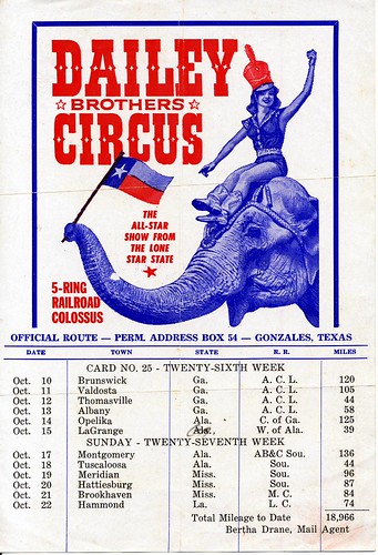
I'm curious about the 44 mile jump between Montgomery and Tuscaloosa. This distance is much longer on a "as the crow flies" routing today. Does anyone have an appropriate railroad map of the time that would show how this jump was accomplished?
Post a Comment